 |
 |
 |
 |
![]()
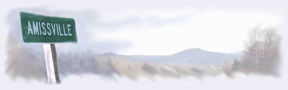
Amissville VA - Early History
Amissville is located on the eastern end of Rappahannock County in the foothills of the Blue Ridge Mountains. It lies on the traditional east-west route between Warrenton, several Rappahannock River crossings, Washington VA and Sperryville. Maps as early as 1770 show the pronounced long curve of the road here as it passes south of the escarpment along easier, less sloping ground. Traffic reaching here will have traversed several lengthy hills coming west from the river; thus, this location became a common spot to rest and refresh. It appears Mr. Joseph Amiss and Mr. Joseph Bayse recognized this and, receiving a grant from Lord Fairfax in 1763, settled here. The first settlers were mostly French Huguenots and English. The stone house that still sits along Lee Highway on the western edge of the "village" area was built in 1784.
In 1810 the US Post Office was established here, supporting the mail run from Warrenton to Thornton Gap (Sperryville). However, the village was still without a name. Candidates proposed were Bayseville or Amissville. Depending on the story one believes, a name was selected either by a vote or a horse race. In any case, Amissville won.
Throughout the early 1800s, commerce traffic increased and the village grew. However, road conditions were never good and as a result a movement developed which led to both the establishment of Rappahannock County (split from Culpeper County) and the "Sperryville-Rappahannock Turnpike." This private road venture was to place a tollhouse at the east end of the village. The pike was the major corridor for agricultural goods and raw wool transported by four- and six-horse wagons to the Rappahannock River canals and to Falmouth or Warrenton and then to Dumfries or Alexandria on the Potomac.
In 1829 Bayse's donated land for the Methodist Church here, which still stands.
 The
movement of armies through Amissville by both sides in the Civil War further
illustrated the pivotal nature of the village, turnpike and the county
to travel between both the Shenandoah Valley and into Northern Virginia.
In August 1862, "Jeb" Stuart's cavalry began its "ride
around" Gen. Pope just east of the village. Days later Jackson's
Corps moved through Amissville from Jeffersonton to Hinson's Ford and
northeast to the Second Manassas battlefield. Then, again, the Army of
Northern Virginia passed over Chester Gap and Thornton's Gap in their
retreat south from Gettysburg. On July 23-24 Gen. George Custer's Federal
Cavalry Division, encamped at Amissville, moved west to cut the Confederate
march which resulted in engagements at Battle Mountain and Gaines Cross-Roads.
Other encounters occurred around Amissville throughout the war between
elements of the armies including in May 1862, autumn 1862, November 1862
and August-September 1863. Col. John Mosby also operated throughout the
area.
The
movement of armies through Amissville by both sides in the Civil War further
illustrated the pivotal nature of the village, turnpike and the county
to travel between both the Shenandoah Valley and into Northern Virginia.
In August 1862, "Jeb" Stuart's cavalry began its "ride
around" Gen. Pope just east of the village. Days later Jackson's
Corps moved through Amissville from Jeffersonton to Hinson's Ford and
northeast to the Second Manassas battlefield. Then, again, the Army of
Northern Virginia passed over Chester Gap and Thornton's Gap in their
retreat south from Gettysburg. On July 23-24 Gen. George Custer's Federal
Cavalry Division, encamped at Amissville, moved west to cut the Confederate
march which resulted in engagements at Battle Mountain and Gaines Cross-Roads.
Other encounters occurred around Amissville throughout the war between
elements of the armies including in May 1862, autumn 1862, November 1862
and August-September 1863. Col. John Mosby also operated throughout the
area.
One tool that can help a locality to preserve its traditional character is an inventory of historic buildings, places, and events. Piedmont Research Institute's Hal Hunter worked with elders in Amissville, Virginia, to collect information, oral history, and pictures of historic buildings. An outgrowth of that effort is now a county-wide historic buildings survey that is being conducted under the auspices of the Virginia Commonwealth Department of Historic Resources. We are very grateful to Mr. Hunter and all the other contributors in this effort.
On this site we present photos and snippets of information about the homes and some other locations of interest in Amissville, organized by location:


Home | About | Community Organizations | Business Directory | Photo Album